LOCATION
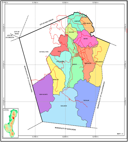
Canlaon City is situated at the eastern side of Mt. Canlaon in the Province of Negros Oriental. It is bounded on the north by the City of San Carlos, on the east by the municipality of Vallehermoso, on the south by the city of Guihulngan, and on the west by the municipality of La Castellana. It is composed of 12 barangays. It has a total land area of 16,662.59 hectares; 6,046.24 hectares of which are considered National Park, Timberland, and Contested areas.
Canlaon City has a soft agricultural, tourism and industrial base to provide a stable economy. It has a rich history of agriculture in such a way that it has played a major role in the economic development and still does today but, despite of the ongoing improvement in terms of technology use and emerging business like of internet cafe, hotels and restaurant the city’s economy lacks large commercial and industrial investors essentially needed in steering the economic activity of the city that’s why for the last 47 years of being a city, Canlaon City had been exhibiting a very slow economic growth.
The six cluster schools compose of twenty three (23) public elementary schools and five (8) secondary schools in the District of Canlaon, Canlaon City, Division of Negros Oriental. These schools were cluster 1: Macario Espanola Memorial School; cluster 2: Bucalan, Budlasan, Guibawan, Pinamentigan and Tabalogo; cluster 3: Kalubihan, Linothangan, Mananawin, Manggapa and Masulog; cluster 4: Aquino, Bayog, Binalbagan, Panubigan and Tigbahi; cluster 5: Gaboc, Lower Lumapao, Malaiba, Minabuntod, Pula, Upper Lumapao and Villa Iowa Elementary School; and cluster 6: secondary schools were Jose B. Cardenas Memorial High School, Uptown Annex, Budlasan, Malaiba, Tabalogo, Bayog, Pula and Masulog High School.
The map of Canlaon city, showing the location of the six clusters with thirty one (31) schools is shown.
CANLAON DISTRICT MAP